
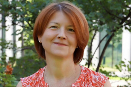

Lendületesek: Kiss Viktória
A Kárpát-medencei bronzkorban hatalmas társadalmi változások zajlottak a mai Magyarország területén élő népességben. Ezeket a folyamatokat, illetve az itt élt emberek jellegzetességeit kutatja Kiss Viktória, a HUN-REN Bölcsészettudományi Kutatóközpont Régészeti Intézet tudományos főmunkatársa, az MTA–BTK Lendület Bázis Kutatócsoport vezetője és munkatársai. Vizsgálataikhoz a legmodernebb informatikai és genetikai, illetve izotóp-geokémiai módszereket hívják segítségül.
TOVÁBB
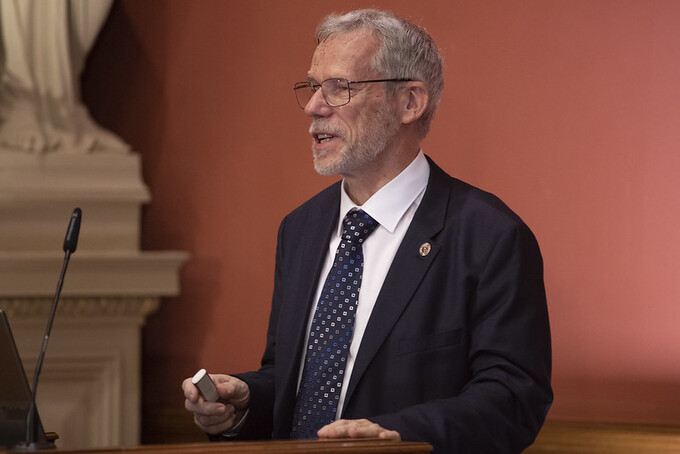
A négydimenziós tér kibogozása – bemutatjuk Stipsicz András ERC-nyertes kutatási témáját
Az Európai Kutatási Tanács Advanced Grant támogatása csaknem 800 millió forinttal jár, amit az utolsó fillérig tiszta matematikára lehet elkölteni. Stipsicz András pedig ebből a pénzből nem kisebb feladatra vállalkozott, mint hogy kollégáival a négydimenziós tér törvényszerűségeit vizsgálja. Cikkünkben kísérletet teszünk arra, hogy bemutassuk, mire is készül.
TOVÁBB

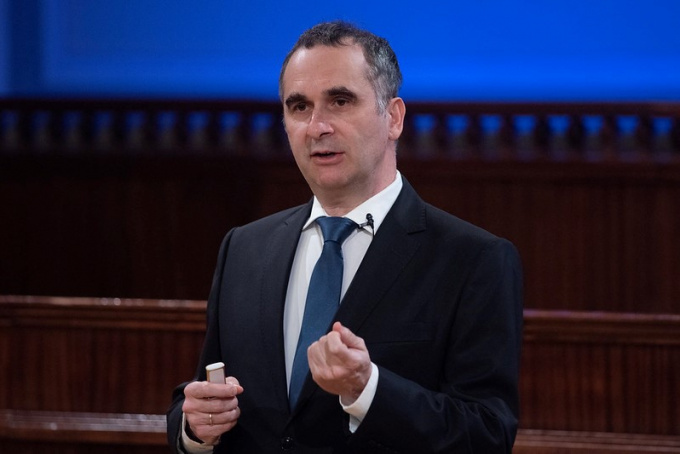
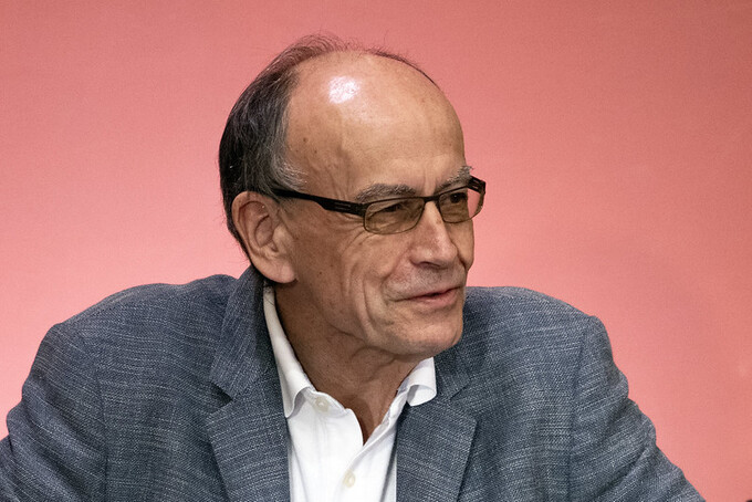
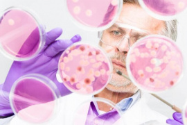
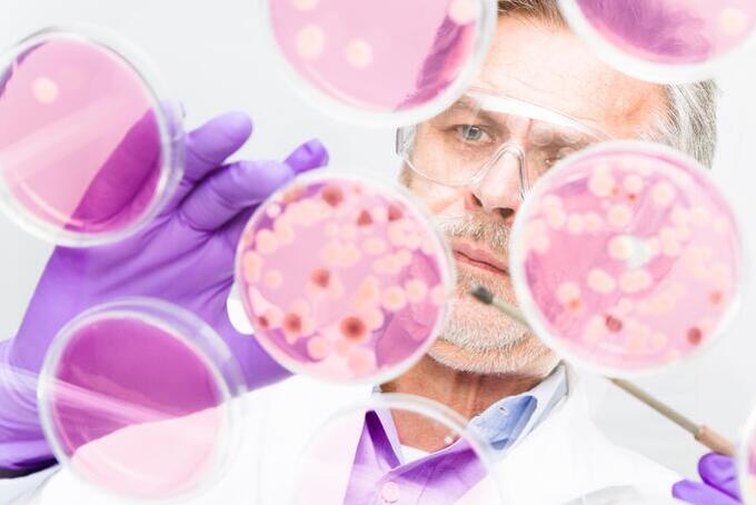
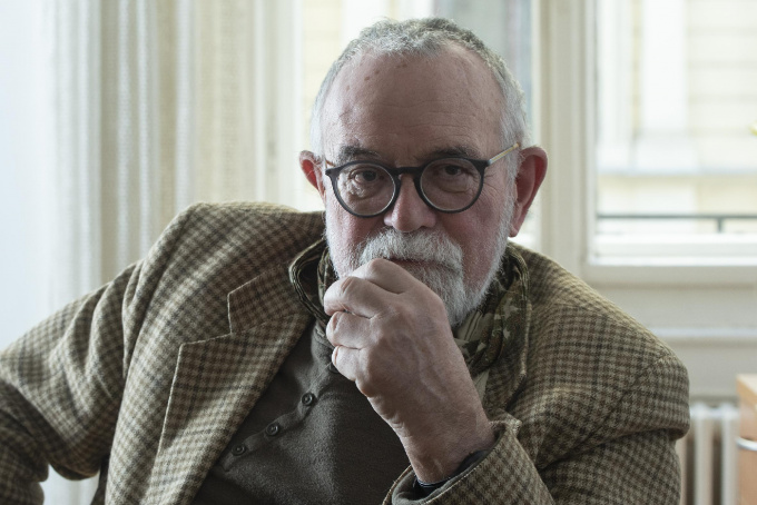
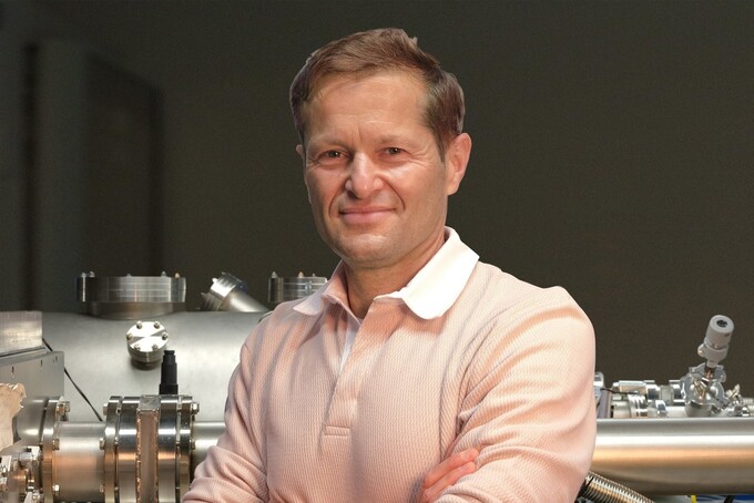
Rossz hírek az új antibiotikumokról – interjú Pál Csaba akadémikussal
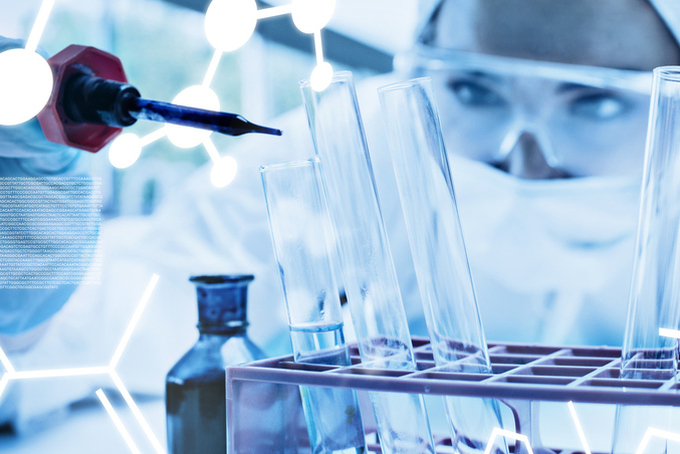
Pál Csaba, a HUN-REN Szegedi Biológiai Kutatóközpont tudományos tanácsadója már negyedszer nyerte el az Európai Kutatási Tanács (ERC) támogatását: most a zsűri a vezető kutatóknak szóló Advanced Grant kategóriában ítélte támogatásra érdemesnek a pályázatát. A téma korunk (pontosabban a közeljövő) talán legsúlyosabb egészségügyi problémája – sokak szerint előrelátható katasztrófája –: a baktériumok antibiotikum-rezisztenciája. A kutató munkatársaival azt fogja vizsgálni, hogy a gyógyszergyártók által most fejlesztett új típusú antibiotikumok mennyire ellenállók a baktériumok ellenálló képességével szemben.
TOVÁBB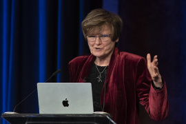

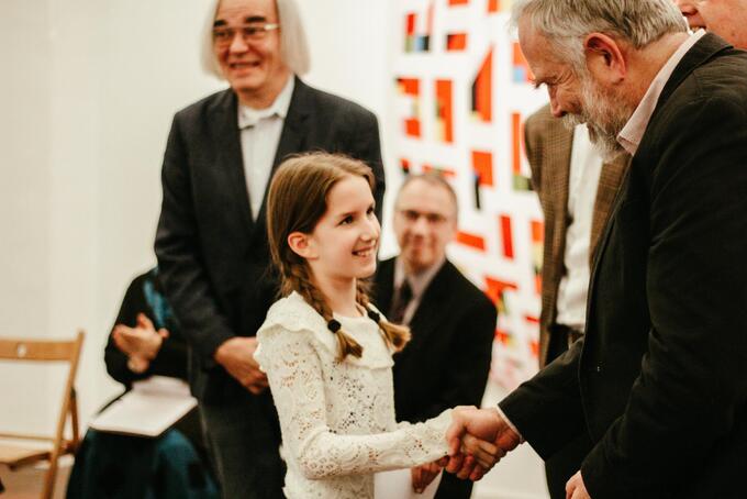
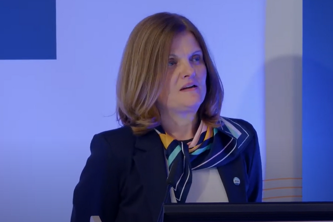
Az mRNS terápiás alkalmazása – Karikó Katalin tiszteleti tag székfoglaló előadása
Karikó Katalin tiszteleti tag 2024. április 9-én tartotta akadémiai székfoglalóját. Az előadásról szóló, képgalériával és videóval bővített összefoglaló.
TOVÁBB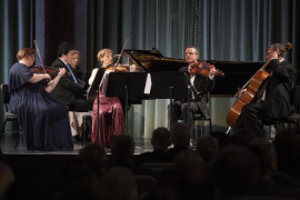
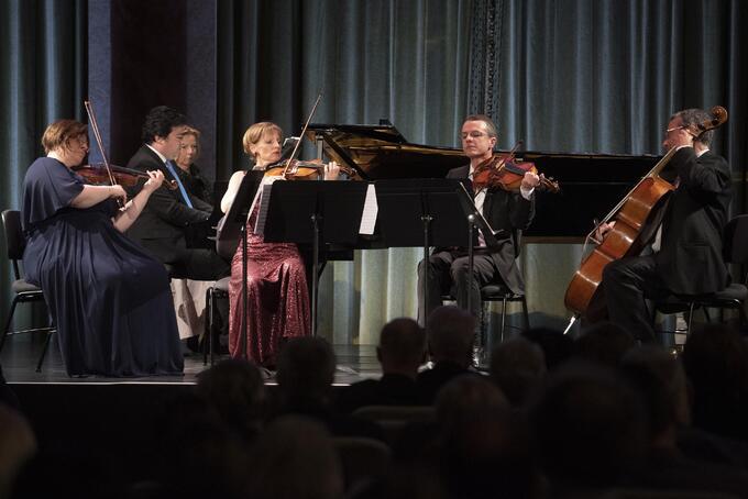
„Egészséges örömforrás” – Művészeti estek az Akadémián XI.
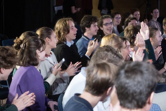
Mendelsshon és Dohnányi ifjúkori remekművei, Atlasz Gábor festőművész képei és a csopaki Jásdi Pincészet borai voltak a Magyar Tudományos Akadémia és az Akadémiai Klub Egyesület tizenegyedik alkalommal, április 8-án megrendezett művészeti estjének fókuszában. A Pesti Vigadóban a Grassalkovich Vonósnégyes és Balázs János Kossuth-díjas zongoraművész által adott hangversenyen, majd az MTA Székház Vörösmarty- és Kodály-termében rendezett kiállításmegnyitón és borbemutatón a jelenlévők megtapasztalhatták, hogy a művészet egészséges örömforrás.
TOVÁBB
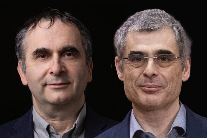
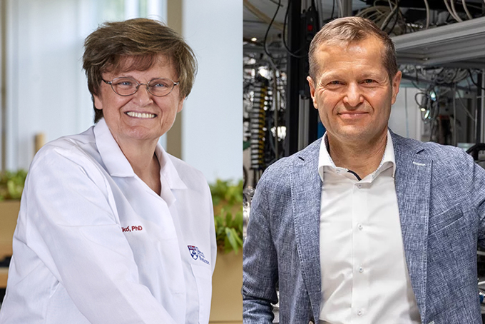
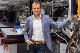
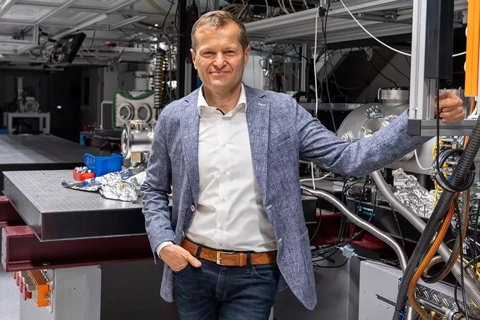
Stipsicz András és Pál Csaba akadémikusok elnyerték az Európai Kutatási Tanács Advanced Grantjét
Stipsicz András matematikusnak, az MTA rendes tagjának és Pál Csaba biológusnak, az MTA levelező tagjának is odaítélte az Európai Kutatási Tanács az elmúlt tíz évben jelentős kutatási eredményeket elérő, vezető kutatók számára kiírt Advanced Grantet.
TOVÁBB
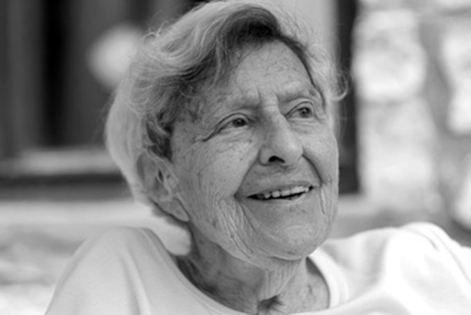
Ferge Zsuzsa, a társadalmi egyenlőtlenségek úttörő kutatója
Életének 93. évében, 2024. április 4-én elhunyt Ferge Zsuzsa szociológus, a Magyar Tudományos Akadémia rendes tagja, a magyar és a nemzetközi társadalomtudomány meghatározó alakja.
TOVÁBB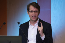

A látás helyreállítása optogenetikai módszerekkel – Roska Botond külső tag székfoglaló előadása
Roska Botond külső tag 2024. március 12-én megtartotta akadémiai székfoglalóját. Az előadásról szóló, képgalériával és videóval bővített összefoglaló.
TOVÁBB
Elhunyt Ferge Zsuzsa szociológus, az MTA rendes tagja
Életének 93. évében, 2024. április 4-én elhunyt Ferge Zsuzsa szociológus, a Magyar Tudományos Akadémia rendes tagja.
TOVÁBBKínai delegáció a Magyar Tudományos Akadémián
2024. április 8-án a Kínai Tudományos Akadémia (CAS) delegációja látogatást tett a Magyar Tudományos Akadémián, hogy a felek megtárgyalják négy évtizede fennálló tudományos kapcsolataik bővítésének és a 3. Selyemút Fórum Budapesten – az MTA alapításának 200. évfordulójához kapcsolódó eseménysorozat részeként – történő megrendezésének lehetőségét.
TOVÁBB
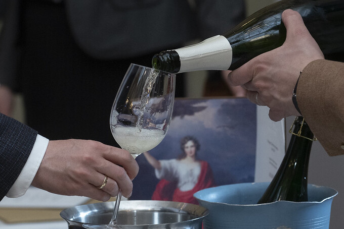
Széles körű szakmai érdeklődés, kiemelkedő pezsgősor az akadémiai borversenyen
Tokaj, Csopak, Szekszárd és Villány borai taroltak az MTA idei borversenyén. A borok mellett kiemelkedő minőségű pezsgősor mutatta meg, hogy ez a kategória is a nemzetközi élvonalat képviseli.
TOVÁBB
Magyar agykutató irányításával oldották meg a memória egyik nagy talányát
Rengeteg élmény ér minket nap mint nap, de ezeknek csak egy része rögzül a memóriánkban. Egészen eddig azonban az idegkutatók sem tudták, hogy milyen mechanizmus „jelöli meg” a megjegyzésre érdemes információkat. Buzsáki György, a New York-i Egyetem Idegtudományi Központjának Biggs-professzora, a Magyar Tudományos Akadémia külső tagja és munkatársai a Science folyóiratban publikálták legújabb felfedezéseiket, amelyek arra utalnak, hogy a Buzsáki által negyven éve felfedezett, úgynevezett „éleshullám-fodrozódások” (az idegsejtek rendkívül gyors ütemű szinkronizált tüzelése) emelnek ki bizonyos élményeket, amelyek aztán az alvás során újból lejátszódnak, és így rögzülnek.
TOVÁBB

Akadémiai támogatás az MTA doktora cím megszerzéséhez és a tudományos eredmények publikálásához kisgyermekes kutatóknak
Negyvenhárom fiatal kutató nyerte el a Magyar Tudományos Akadémia pályázatán azt az ösztöndíj-támogatást, amelyet az MTA a gyermeket nevelő kutatók tudományos előmenetelének elősegítése érdekében hirdetett meg.
TOVÁBB_1-7_screenshot_680_454_1711615244_fill_270x180.png)
_1-7_screenshot_680_454_1711615244_fill_680x454.png)
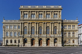
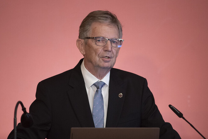
Tájékoztatás az MTA Székház rekonstrukciójának előrehaladásáról
A Székház-rekonstrukció I. ütemének megvalósítása 2023 júliusában kezdődött meg az Akadémia saját forrásából, és a 2025-ben sorra kerülő ünnepi eseményekig befejeződik. Oberfrank Ferenc köztestületi igazgató tájékoztatása a felújítás jelenlegi helyzetéről.
TOVÁBB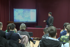

Mi lett volna, ha? – Videón Ablonczy Balázs történész a Középiskolai MTA Alumni Programban tartott előadása
Alakulhattak volna-e másként a történelmi események az első világháború után, ha adott döntési pontokon másként határoz a politikai elit vagy a társadalom egy része? Egyebek mellett erre a kérdésre kereste a választ Ablonczy Balázs történész a Középiskolai MTA Alumni Program keretében gimnazistáknak tartott előadásában.
TOVÁBB
Az ALLEA nyilatkozata az európai kutatás és innováció jövőjéről
Az ALLEA tavaly év végén hozta nyilvánosságra nyilatkozatát arról, milyennek szeretné látni az EU soron következő kutatási és innovációs keretprogramját, az FP10-et. Bár még 4 év van az FP10 indulásáig, amely a 2028–2034 közötti időszakot fedi majd le, a keretprogram tartalmának és pénzügyi hátterének tervezése már elindult az Unió szakértő testületeinek berkeiben. Ebbe a tervezési folyamatba illeszkedik az ALLEA legfrissebb nyilatkozata, amely külön hangsúlyozza az Európai Kutatási Térség tagországainak és intézményeinek minél szélesebb körű bevonását az európai kutatási keretprogramba.
TOVÁBB
Lendületesek: Király Ildikó
Beszélgetéseink során gyakran idézünk fel olyan emlékeket, és meséljük el őket lelkesen, teljes átéléssel a beszélgetőtársainknak, amelyek valójában meg sem történtek, csupán elménk szüleményei. Ezek nem hazugságok, hiszen mi magunk is úgy hisszük, hogy valóban megtörténtek velünk. Király Ildikó egyetemi tanár, az ELTE Kognitív Pszichológia Tanszék vezetője és a Lendület MTA–ELTE Társas Elmék Kutatócsoport vezetője és munkatársai ezen emlékek kialakulását, működését és adaptív szerepét fogják kutatni az elkövetkező években. Hiszen úgy tűnik, e konstruált emlékek fontos szerepet töltenek be társas kapcsolatainkban.
TOVÁBB

Erdős spaces – Jan van Mill tiszteleti tag székfoglaló előadása
Jan van Mill tiszteleti tag 2023. október 9-én megtartotta akadémiai székfoglalóját. Az angol nyelvű előadásról szóló, képgalériával és videóval bővített összefoglaló.
TOVÁBB
Kitüntetések a nemzeti ünnepen – Széchenyi-díj, Magyar Érdemrend
Magyarország köztársasági elnöke március 15. alkalmából kitüntetéseket adományozott. A Széchenyi-díjakat és a Magyar Érdemrend parancsnoki keresztje kitüntetéseket a Parlament kupolacsarnokában, a Magyar Érdemrend további fokozatait a Pesti Vigadóban tartott ünnepségen adták át.
TOVÁBB
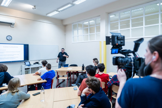
Hogyan hozzuk le a csillagokat az égről? – Videón Pokol Gergő fizikus a Középiskolai MTA Alumni Programban tartott előadása
Miként lehet a csillagok energiáját békés célokra használni itt, a Földön? Hogyan lehet ezeket a hatalmas energiákat megszelídíteni? Mi kell ahhoz, hogy a nem túl távoli jövőben már működhessenek az úgynevezett fúziós erőművek? Egyáltalán: lehetséges-e a fúzión alapuló energiatermelés? Többek között ezekre a kérdésekre kaphattak választ az érdeklődő gimnazisták Pokol Gergő előadásából.
TOVÁBB
Növekedés csoportokban és Klasszifikációmentes bizonyítások – Pyber László rendes tag székfoglaló előadása
Pyber László rendes tag 2023. szeptember 27-én megtartotta akadémiai székfoglalóját. Az előadásról szóló, képgalériával bővített összefoglaló.
TOVÁBB
Hűség a hagyományokhoz és folyamatos megújulás – megtartották a területi akadémiai bizottságok éves közgyűléseit
„A Magyar Tudományos Akadémia egyik legfőbb erénye az elmúlt két évszázadban éppen az volt, hogy miközben hű maradt hagyományaihoz, ápolta az elődöktől, az egymást követő tudósgenerációktól örökül hagyott tradíciókat, képes volt folyamatosan megújulni” – így hangzott az MTA Elnökségének tagjai által a területi bizottságok éves közgyűlésein tartott köszöntők egyik legfőbb üzenete. Az Akadémia fennállásának 200. évfordulójához közeledve az idei év egyik kiemelt témája Debrecenben, Miskolcon, Pécsett, Szegeden és Veszprémben is a hagyomány és megújulás jegyében megvalósuló ünnepi készülődés volt.
TOVÁBB
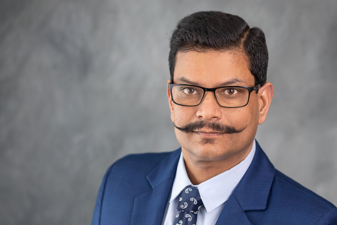
Az MTA doktorai: Bhattoa Harjit Pal a D-vitamin élettani jelentőségéről
A D-vitaminnak a legkülönfélébb biológiai folyamatokban játszott szerepe a vitaminokkal kapcsolatos kutatások talán legnépszerűbb területének számít napjainkban. Bhattoa Harjit Pal, a Debreceni Egyetem Laboratóriumi Medicina Intézet egyetemi docense, az MTA doktora már negyedszázada vizsgálja a D-vitamin csontrendszerre gyakorolt hatását (és így szerepét a csontritkulás kialakulásában), de ugyanígy kutatja munkatársaival a vitamin általános élettani és betegségekben játszott szerepét.
TOVÁBB
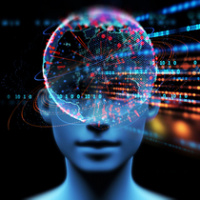
Lendületesek: Gali Ádám
A kvantumtechnológia az elektronika számos ágát forradalmasíthatja, a kommunikációtól az érzékelőkön keresztül a számítástechnikáig. Gali Ádám egyetemi tanár, a Wigner Fizikai Kutatóközpont Szilárdtestfizikai és Optikai Intézet tanácsadója, a Félvezető Nanoszerkezetek Lendület Kutatócsoport vezetője már jó ideje kutatja a szilárd testekben létrejövő kvantumbiteket. Tavaly óta pedig immár haladó Lendület-pályázat nyerteseként folytatja a kutatásait. Eredményei nyomán kutatótársaival közösen lerakhatják az újfajta kvantumszenzorok alapjait.
TOVÁBB
The molecular architecture of synapses in health and disease – Thomas C. Südhof tiszteleti tag székfoglaló előadása
Thomas C. Südhof tiszteleti tag 2023. szeptember 20-án megtartotta akadémiai székfoglalóját. Az angol nyelvű előadásról szóló, képgalériával és videóval bővített összefoglaló.
TOVÁBB
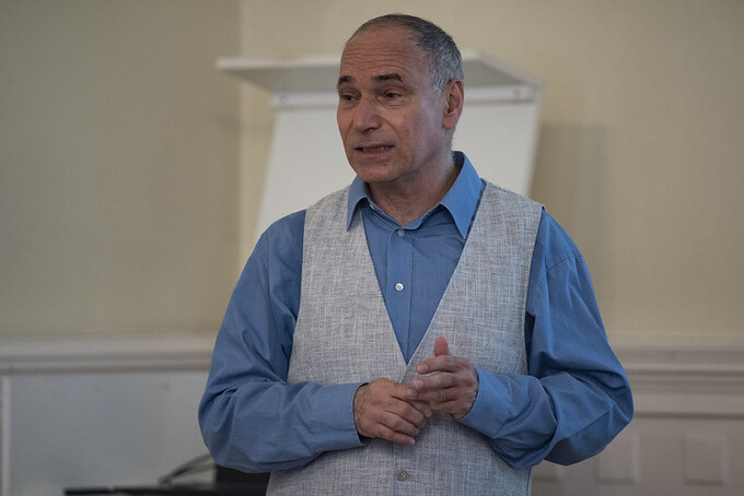
Lehetőségek a hidrogén kémiai úton történő tárolására – a sokszínű hangyasav – Laurenczy Gábor külső tag székfoglaló előadása
Laurenczy Gábor külső tag 2023. szeptember 12-én megtartotta akadémiai székfoglalóját. Az előadásról szóló, képgalériával és videóval bővített összefoglaló.
TOVÁBB
Lendületesek: Orbulov Imre Norbert
A kompozit fémhabok az utóbbi évtizedekig az ipar számos területén jelentős szerepre tettek szert (például használják őket épületek és járművek ütközés- és robbanásvédelmében), de a fejlesztésük eddig használt módszerei már egyre kevésbé kínálják a továbblépés lehetőségét. Orbulov Imre Norbert, a Budapesti Műszaki és Gazdaságtudományi Egyetem Gépészmérnöki Karának dékánja, az Anyagtudomány és Technológia Tanszék egyetemi tanára, az MTA-BME Lendület Nagyteljesítményű Kompozit Fémhabok Kutatócsoport vezetője és munkatársai ezért a fémhabok fejlesztésének merőben új megközelítéseit kutatják, hogy a segítségükkel a maiaknál jelentősen jobb tulajdonságokkal bíró anyagokat fejlesszenek ki.
TOVÁBB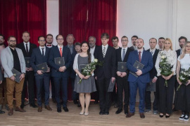
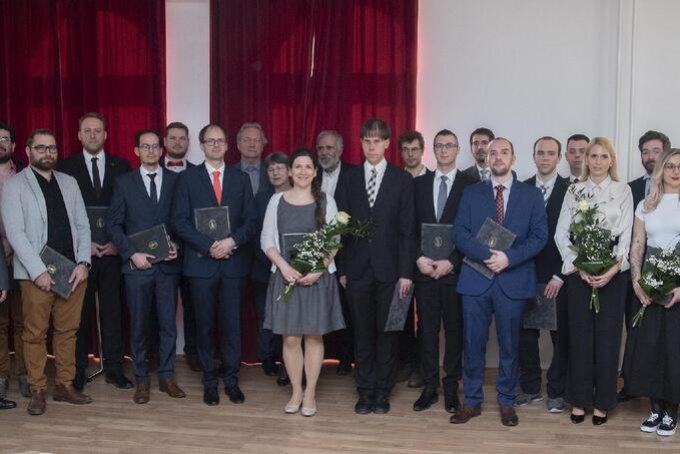
„Bátorítás az úton” – Átadták az Akadémiai Ifjúsági Díjakat
Huszonöt fiatal kutató vehette át idén az Akadémiai Ifjúsági Díjat, a Magyar Tudományos Akadémia rangos elismerését. 2024-ben a bölcsészet- és társadalomtudományok területéről hét, az élettudományok területéről szintén hét, a matematikai és természettudományok területéről pedig tizenegy fiatal díjazott kutatót köszönthetünk.
TOVÁBB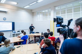
Kell egy kicsit fölfelé is néznünk – Videón Kiss L. László csillagász, akadémikus a Középiskolai MTA Alumni Programban tartott előadása
Miért érdemes egy kutatónak világot látni, majd miért tér haza mégis? Mitől meghatározó a kutatói munka mellett az eredmények publikálása? Mit kell tenni azért, hogy az MTA doktora, majd az Akadémia rendes tagja váljon egy kutatóból? Egyebek mellett ezekre a kérdésekre is választ kaphattak a budapesti Alternatív Közgazdasági Gimnázium diákjai Kiss László akadémikusnak a Középiskolai MTA Alumni Program keretében tartott előadásából, amelyen az is kiderült, hogy mitől is olyan izgalmas az exobolygók kutatása. A rendezvényen forgatott kisfilmek a cikkben megnézhetők.
TOVÁBB
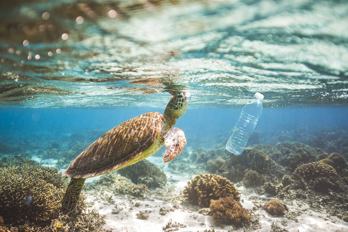
A műanyagszemét korlátozásához körforgásos gazdaságra van szükségünk az EASAC szerint
Rendszerszintű hiányosságok miatt termelünk és használunk fel egyre több műanyagot, s így egyre több műanyag kerül ki tengeri, szárazföldi és édesvízi élőhelyekre – derül ki az Európai Akadémiák Tudományos Tanácsadó Testülete, az EASAC a legújabb kutatásokat összefoglaló kommentárjából. Ha maradnak a jelenlegi üzleti eljárások és fogyasztási mintázatok, akkor a műanyaghulladék mennyisége globálisan várhatóan majdnem a háromszorosára nő 2060-ig. Az EASAC átfogó reformokat javasol az élőhelyek és az emberi egészség megóvása érdekében.
TOVÁBB
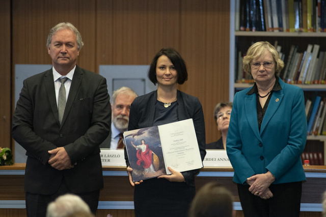
Erdélyi kiadványok, tudományos kötetek, ritka nyomtatványok – három hagyatékból származó gyűjteményekkel gazdagodott az MTA Könyvtár és Információs Központ
Benkő Samu erdélyi művelődéstörténész, az MTA külső tagja, Frank Tibor történész, az MTA rendes tagja, valamint Horváth József bibliográfus, antikvárius örökösei egyaránt a Magyar Tudományos Akadémia Könyvtár és Információs Központ számára ajánlottak fel olyan könyv- és nyomtatványritkaságokat is tartalmazó hagyatékokat, amelyek kutatók számára is fontos források lehetnek. Az adományok befogadásáról Monok István, az MTA KIK főigazgatója javaslata és Kollár László Péter, az MTA főtitkárának előterjesztése alapján a Vezetői Kollégium döntött.
TOVÁBB

Az MTA doktorai: Tóvári József a daganatok áttétképzésének kutatásáról
A daganatos megbetegedések eredményes gyógyítása érdekében nemcsak az elsődleges tumor növekedését lehet gátolni, hanem elméletben az áttétképződés is megakadályozható vagy legalábbis lassítható. Tóvári József, az MTA doktora, az Országos Onkológiai Intézet Onkológiai Kutató Központ Kísérletes Farmakológiai Osztály vezetője kutatásainak fókuszában a daganatáttét-képződés molekuláris mechanizmusai állnak, az eredményei pedig egy napon talán elvezetnek a túlélési esélyeket drasztikusan csökkentő áttétek kialakulásának hatékony gátlásához.
TOVÁBB

Kalandozások az elektroforézis birodalmában – Vigh Gyula külső tag székfoglaló előadása
Vigh Gyula külső tag 2023. szeptember 12-én megtartotta akadémiai székfoglalóját. Az előadásról szóló, képgalériával és videóval bővített összefoglaló.
TOVÁBB

Legyőzhetetlen növénykórokozók – Kiss Levente külső tag székfoglaló előadása
Kiss Levente külső tag 2023. szeptember 5-én megtartotta akadémiai székfoglalóját. Az előadásról szóló, képgalériával és videóval bővített összefoglaló.
TOVÁBB
Lendületesek: Szilágyi Emőke Rita
A 15–17. századból az emberek többsége csupán néhány jelentős magyar humanista szerzőt ismer. Szilágyi Emőke Rita, a Bölcsészettudományi Kutatóközpont Irodalomtudományi Intézet tudományos munkatársa, a Humanista kánonok és identitások a Magyar Királyságban 1450–1630 Lendület-kutatócsoport vezetője e hiányosságot igyekszik orvosolni. Az MTA Lendület Programjának támogatásával azt vizsgálja, hogy az 1400–1600-as években aktív szerzők közül kik és miért maradtak meg a köztudatban, vagy éppen miért estek ki onnan.
TOVÁBB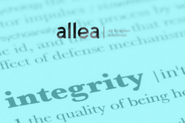

Magatartási kódex kutatóknak: magyarul is olvasható az ALLEA kiadványa
Az önszabályozás keretrendszere a kutatói közösség számára – röviden így határozták meg szerkesztői „A kutatási integritás európai magatartási kódexé”-t, amelynek átdolgozott kiadása immár magyarul is elérhető. Az Európai Nemzeti Tudományos Akadémiák Szövetsége (ALLEA) kiadványa online letölthető cikkünkből.
TOVÁBB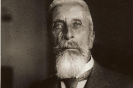
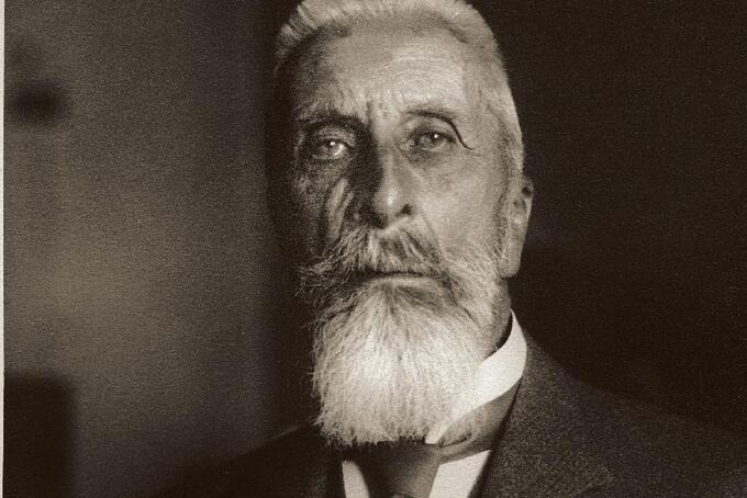
Akadémikusok emlékezete – Apponyi Albert
Apponyi Albertet úgy ismerjük, mint a 20. század elejének egyik legbefolyásosabb közéleti személyiségét, a kultuszminiszteri posztot több kormányban is betöltő, az első világháború idején pedig a választójog demokratikus kiterjesztését követelő politikust. Életútja legemlékezetesebb epizódja az 1920-as párizsi békekonferencián a magyar delegáció vezetőjeként vívott küzdelme a méltányos feltételekkel megkötendő békeszerződésért a háborúban vesztes Magyarország számára. Azt már kevesebben tudják róla, hogy a Magyar Tudományos Akadémia tagja is volt. Életútját az Akadémikusok emlékezete című sorozat legújabb részeként Hamza Gábor akadémikus, az Eötvös Loránd Tudományegyetem Római Jogi és Összehasonlító Jogtörténeti Tanszékének professor emeritusa idézi fel.
TOVÁBB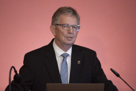
Makro, mini, mikro és nano kémiai szenzorok – Lindner Ernő külső tag székfoglaló előadása
Lindner Ernő külső tag 2023. június 22-én megtartotta akadémiai székfoglalóját. Az előadásról szóló, képgalériával és videóval bővített összefoglaló.
TOVÁBB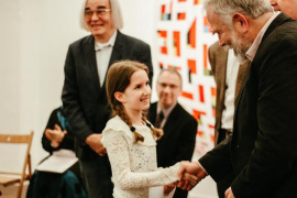
Bolyai APP&X – diákok és tanárok kiváló pályamunkáit díjazták
Tizenhat diáknak és tizenkét tanárnak adtak át díjat a Bolyai János Matematikai Társulat „APP&X” című pályázatának ünnepélyes eredményhirdetésén 2024. január 20-án. A 3-13. évfolyamos diákoknak kiírt pályázatot a Magyar Tudományos Akadémia és a Középiskolai MTA Alumni Program is támogatta.
TOVÁBB
The Science of Diastole – Kovács Sándor tiszteleti tag székfoglaló előadása
Kovács Sándor tiszteleti tag megtartotta akadémiai székfoglalóját. Az angol nyelvű előadásról szóló, képgalériával és videóval bővített összefoglaló.
TOVÁBB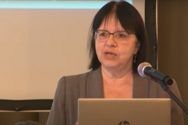
Az atombomba feltalálásától a nukleáris fegyverek betiltásáig – Videón Nagyné Rózsa Erzsébet, az MTA doktora Alumni-előadása
Atomsorompó, atomcsend, atomfegyvermentes övezetek – fogalmak, amelyekkel gyakran találkozhatunk, de azt már sokkal kevesebben tudják, hogy mit is jelentenek. A választ a budapesti Teleki Blanka Gimnázium diákjainak Nagyné Rózsa Erzsébet, az MTA doktora, a Nemzeti Közszolgálati Egyetem egyetemi tanára adta meg, aki a Középiskolai MTA Alumni Program keretében tartott előadásán arról is beszélt, hogy feltartóztathatók-e a nukleáris fegyverek.
TOVÁBB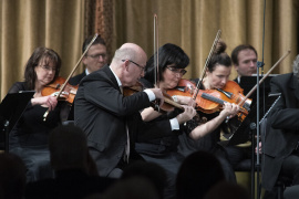
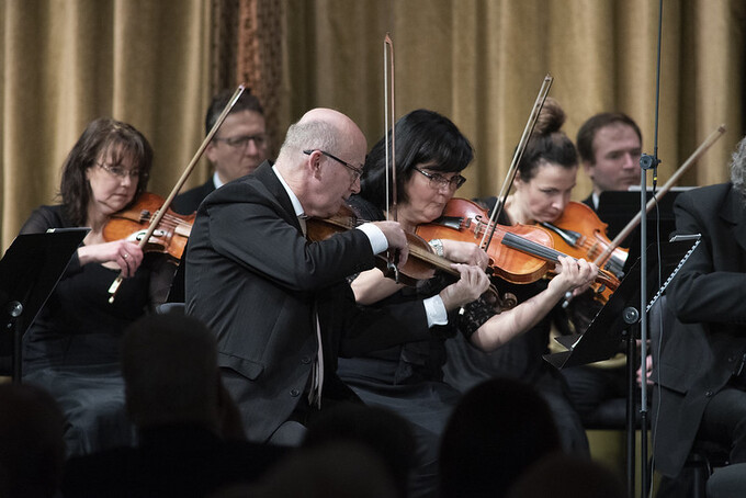
„Nemzetek feletti kultúrkincsek” – Művészeti estek az Akadémián X.
Haydn és Mozart művei, Veress Sándor László Munkácsy-díjas festőművész képei és Balla Géza ménesi borász pincészetének borai voltak a Magyar Tudományos Akadémia és az Akadémiai Klub Egyesület tizedik alkalommal megrendezett közös művészeti estjének fókuszában. A Pesti Vigadóban az Orfeo Zenekar, Szutrély Katalin szoprán énekes és Somlai Petra fortepiano-művész közreműködésével és Vashegyi György vezényletével tartott hangverseny, valamint az MTA Székház Kodály- és Vörösmarty-termében rendezett kiállításmegnyitó és borbemutató a magyar kultúra napjának estéjére esett.
TOVÁBB
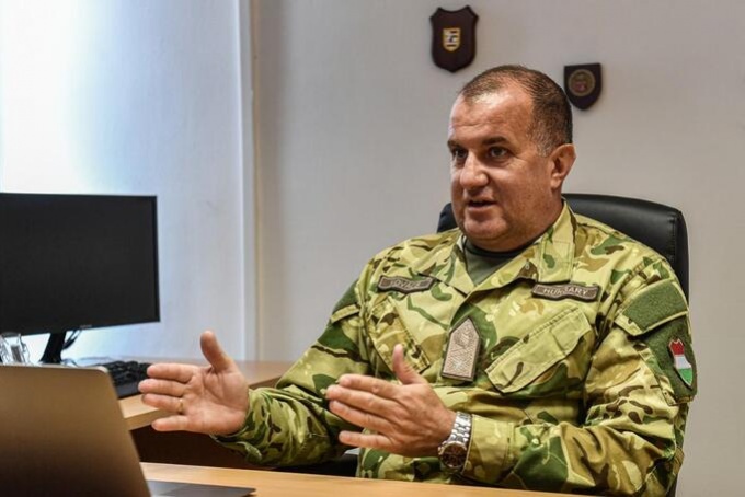
Az MTA doktorai: Kovács László a kiberhadviselésről
Kovács László dandártábornok, a Nemzeti Közszolgálati Egyetem Elektronikai Hadviselés Tanszék egyetemi tanára A kiberbiztonság stratégiai megközelítése című értekezésével nyerte el az MTA doktora címet. Fő kutatási területe a kiberhadviselést meghatározó nemzeti stratégiák összehasonlítása, és az időtálló nemzeti stratégia kidolgozása, amely lehetővé teszi, hogy a szélvészgyorsan fejlődő információtechnológia, a mesterséges intelligencia és a kvantum-számítástechnika korában is lépést tudjunk tartani a komputerrendszereket fenyegető ellenséges támadásokkal szemben. Az MTA doktorairól szóló sorozatunkban a címet a legkülönbözőbb tudományterületeken elért eredményeikkel elnyerő kutatókat mutatunk be.
TOVÁBB
Lendületesek: Szécsényi-Nagy Anna
Bár a római korról sok írásos forrás áll a rendelkezésünkre, a Pannoniában lakó népesség biológiai, orvosi, táplálkozási és sok egyéb jellegzetességéről nagyon keveset tudunk. Ezt orvosolják majd Szécsényi-Nagy Anna archeogenetikus, régész, a HUN-REN Bölcsészettudományi Kutatóközpont Archeogenomikai Intézet tudományos főmunkatársa, az MTA-BTK Lendület Biorégészet Kutatócsoport vezetője és munkatársai kutatásai, akik például a rómaiak által idehozott tevéket is vizsgálni fogják.
TOVÁBB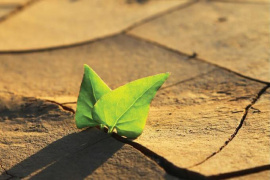

A tudományünnepről ajánljuk: Éghajlatváltozás, időjárási szélsőségek és a tudomány javaslatai
Melyek az éghajlatváltozás legfontosabb környezeti, társadalmi és gazdasági következményei? Miként lehetséges az éghajlatváltozás által előidézett és befolyásolt jelenségek feltárása, monitorozása és modellezése, valamint a kockázatok mérséklésére adott válaszok tudományos megalapozottságú tervezése? Erről is beszéltek a téma legkiválóbb hazai kutatói a 49. Meteorológiai Tudományos Napok rendezvényén, amelyet a Magyar Tudomány Ünnepe keretében tartottak. Az mta.hu videós összeállítása a cikkben nézhető meg.
TOVÁBB
Freund Tamás: Az ország és a magyar kutatás alapvető érdeke az, hogy az egyetemek ismét az uniós Horizont programban vehessenek részt
Freund Tamás, a Magyar Tudományos Akadémia elnöke a Népszavának nyilatkozva arról beszélt: bár a Hu-rizont program nélkülözhetetlen a károk mérsékléséhez, mielőbb el kell hárítani a politikai akadályokat az elől, hogy minden magyar kutatóhely ismét teljes- és egyenjogú, diszkriminációmentes résztvevője legyen az európai kutatási térségnek.
TOVÁBB
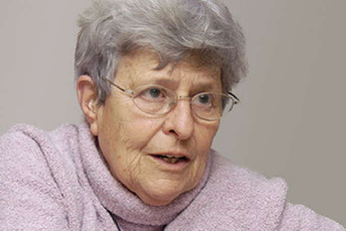
A tudományünnepről ajánljuk: Ki tekinthető szegénynek? A statisztikus válaszol
A szegénység nem szűkíthető le egyszerűen az adott személy jövedelmi-pénzügyi helyzetére. Az, hogy valakit szegénynek tart-e a kutató, attól is függ, hogy az illető miként fér hozzá bizonyos javakhoz és szolgáltatásokhoz, illetve hogyan jelenik meg a munkaerőpiacon. Egyebek mellett erről beszélt az MTA Statisztikai és Jövőkutatási Tudományos Bizottságának rendezvényén Ménesi Éva, a Központi Statisztikai Hivatal vezető főtanácsosa. Az előadásáról készült videófelvétel cikkünkben megtekinthető.
TOVÁBB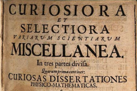

Az első magyar „szenvedelmes ismeretterjesztő”
Ötvenhat kötet, benne elsősorban matematika és természettudományi, azon belül fizikai és csillagászati témájú munkák, ezeken kívül azonban történettudományi, hadtudományi, jogi és teológiai, művek is - így összegezhető röviden a tizenhetedik századi polihisztor, az első ismeretterjesztőnek nevezhető Szentiványi Márton életműve. A nagyszombati jezsuita tanár életének főbb állomásait Csaba György Gábor idézi fel az mta.hu számára írott cikkében.
TOVÁBB

A tudományünnepről ajánljuk: Média és politika a mesterséges intelligencia térhódításának korában
Ember és gép együttműködik – ez már régóta így van, de gépeink egyre okosabbak lesznek. Manapság már nem egyértelműen alá- és fölérendelt viszonyban állunk, hanem fokozatosan kiegyensúlyozódnak a szerepek. A mesterséges intelligencia vezérelte gépek néha döntenek, néha alkotnak, néha vezetnek – és néha megvezetnek. Bokor Tamás kommunikáció- és médiakutató, tréner, a BCE docense előadásban erről az újraalakuló ember-gép viszonyról beszélt. Kitért arra is, hogy mindez milyen lehetőségeket és milyen veszélyeket rejt magában. Az előadásról készült videófelvétel a cikkben megnézhető.
TOVÁBB

Mi történt azután? A kőzetképződést követő események termo- és hidrokronológiája – Dunkl István külső tag székfoglaló előadása
Dunkl István külső tag 2023. június 20-án megtartotta akadémiai székfoglalóját. Az előadásról szóló, képgalériával és videóval bővített összefoglaló.
TOVÁBB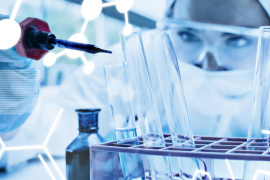
Megjelent az MTA Prémium Posztdoktori Kutatói Programja ösztöndíjasainak összefoglalóit tartalmazó újabb kötet
Húsz kutató záróbeszámolója olvasható abban az új kiadványban, amelyben az MTA által támogatott program keretében elért fő kutatási eredményeiket összegezték a posztdoktorok. A kiadvány cikkünkből letölthető.
TOVÁBB

Új ruhában a 200 éves születésnap előtt: megújult a Magyar Tudományos Akadémia arculata
A 2025-ös bicentenáriumhoz közeledve régi adósságát törlesztette az Akadémia: olyan arculatfrissítést hajtott végre, amellyel megtartja hagyományait, de alkalmazkodik a jelenkor vizuális kommunikációs elvárásaihoz és digitális környezetéhez. A megvalósítás lehetőségét meghívásos pályázat útján a DE_FORM Design Agency nyerte el.
TOVÁBB

Lendületesek: Ördögné Kolbert Zsuzsanna
A közeljövőben egyre súlyosabb szárazsággal kell szembenéznie a mezőgazdaságnak, így erősödő stressz közepette kell növelnünk a termelékenységét, hogy az egyre nagyobb létszámú emberiséget is elláthassa élelmiszerrel. Ördögné Kolbert Zsuzsanna, a Szegedi Tudományegyetem Növénybiológiai Tanszékének egyetemi docense, a Lendület Növényi Nanobiológia Kutatócsoport vezetője és munkatársai azt kutatják, hogy a nanoanyagokkal történő magedzés milyen szerepet játszhat a termesztett növények szárazságtűrésének fokozásában.
TOVÁBB
Tizennégy külföldi vendégkutató kapcsolódik be az Akadémia támogatásával a hazai kutatásokba 2024-ben
Új daganatellenes szerek létrehozásához, a szárazság- és sótűrés javítását célzó biotechnológiai programok sikerességéhez, valamint az energia előállításának és tárolásának új, alternatív módjainak kidolgozásához is hozzájárulhatnak azok a kutatások, amelyekben 14 nemzetközi hírű vendégprofesszor vesz részt a Magyar Tudományos Akadémia támogatásával. A magyar kutatócsoportok nemzetközi versenyképességét erősítő program keretében a hazai kutatóközpontokba, kutatóintézetekbe és felsőoktatási intézményekbe az Egyesült Államokból, Németországból, Indiából, az Egyesült Királyságból, Ausztriából, Spanyolországból, Horvátországból, Argentínából, valamint Finnországból érkeznek kutatók.
TOVÁBB
Lendületesek: Toldy Andrea
Hogyan lehet a műanyagok kisebb részét kitevő, úgynevezett térhálós polimerekből keletkező hulladékokat újrahasznosítani? Erre a kérdésre keresi a választ az MTA Lendület Programjának támogatásával Toldy Andrea, a Budapesti Műszaki és Gazdaságtudományi Egyetem Polimertechnika Tanszék egyetemi tanára, az MTA-BME Lendület Fenntartható Polimerek Kutatócsoport vezetője.
TOVÁBB


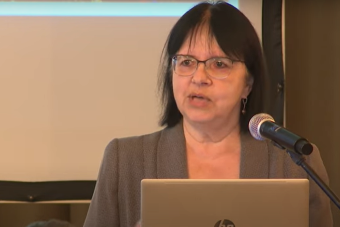
A legfrissebb PISA-felmérések eredményeinek értékelése
A Közoktatás Elnöki Bizottság rendezvénye videón
TOVÁBB

Tájékoztatás a budapesti MTA Székház felújításának megkezdéséről
Az MTA Székház rekonstrukciója egyedülálló feladat az MTA vezetése és szervezete számára, amit a közelgő bicentenárium különösen jelentőssé tesz. Az alábbiakban a most megkezdődött felújítással kapcsolatos legfontosabb információkat ismertetjük.
TOVÁBB
Teljesítmény vizsgálata a (világ)gazdaság működési egysége, az üzleti hálózat esetében – A Világgazdasági Tudományos Tanács 23. ülése videón
Mikrogazdasági megközelítésben, a versenyképesség szempontjából elemezni a nemzetközi nagyvállalatokat és gazdasági hálózataikat – ez volt a célja Gelei Andreának, a Budapesti Corvinus Egyetem Operáció és Döntés Intézete egyetemi tanárának, aki a Világgazdasági Tudományos Tanács decemberi ülésén beszélt eredményeiről.
TOVÁBB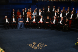
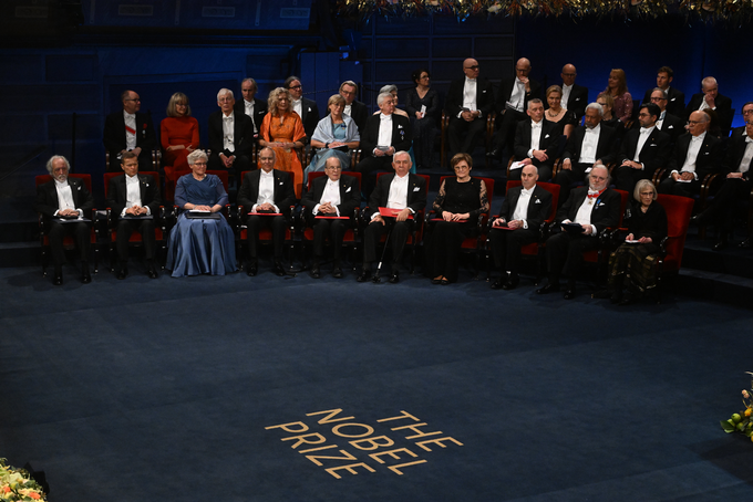
Átvette a Nobel-díjat Stockholmban Karikó Katalin biokémikus és Krausz Ferenc fizikus
A tudományos élet legrangosabb nemzetközi kitüntetését a két díjazott akadémikusnak XVI. Károly Gusztáv svéd király adta át a stockholmi hangversenyteremben rendezett díszes ceremónián.
TOVÁBB

Fiatal Kutatók Akadémiája: A fiatal kutatók helyzete és képviselete Magyarországon - A Magyar Tudomány című folyóirat tematikus összeállítása
Miért fontos a fiatal kutatók részvétele a tudománypolitikában és milyen előzmények után alakult meg 2019-ben a Fiatal Kutatók Akadémiája? Melyek a főbb tanulságai a szervezet eddigi tevékenységének és milyen javaslatokat fogalmaz meg az FKA a magyarországi fiatal kutatók helyzetének javítása érdekében? Ezekre a kérdésekre is válaszolnak annak az összeállításnak a szerzői és szerkesztői, amely a Magyar Tudomány című folyóirat decemberi számában jelent meg.
TOVÁBB

Komprehenzív gyógyítás: a modern klinikai pszichológiai ellátás színterei - Az MTA Elnöki Bizottság az Egészségért tanácskozása videón
Az MTA Elnöki Bizottság az Egészségért a szakirodalom figyelemmel kísérésével rendszeres tudományos elemzéseket végez a 21. századi egészségügy aktuális kérdéseiről azzal a céllal, hogy ajánlásokat fogalmazzon meg a szakpolitika és a döntéshozók, valamint a társadalom számára. Az EBE legutóbbi rendezvénye az egészségügynek egy rendkívül dinamikusan fejlődő területével, a klinikai pszichológiával foglalkozott.
TOVÁBB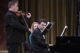

Nyelven túli nyelveken – Művészeti estek az Akadémián IX.
A zeneművészet, a képzőművészet és a bor művészetének nyelven túli nyelvét, összetett élményvilágát hozták el a „Művészeti estek a Magyar Tudományos Akadémián” című rendezvénysorozat 9. alkalmának művész vendégei a Vigadó és az MTA Székház falai közé 2023. november 20-án. Balázs János zongoraművész és Baráti Kristóf hegedűművész közös koncertje, Szakács Imre festőművész kiállításának megnyitója és Tiffán Ede pincészetének borai egy világszínvonalú esemény rangját adták az estének.
TOVÁBB
Sokszínűség a tudományban. Bemutatkoznak a Fiatal Kutatók Akadémiájának tagjai - Videón az előadások
Biológia, kémia, nyelvészet, asztrofizika, társadalomtudomány - a Fiatal Kutatók Akadémiájának tagjai előadásaikkal e tudományterületekre kalauzolták az érdeklődőket tudományünnepi rendezvényükön. Az előadás-sorozat felvétele cikkünkből elérhető.
TOVÁBBMilyen hatást gyakorol a mesterséges intelligencia a fiatal kutatók életére? – Videó a tanácskozásról
Miként alakítja át a tudományos kutatás módszereit a mesterséges intelligencia és ennek nyomán milyen kihívásokkal szembesülnek a tudomány művelői? Ezekre a kérdésekre keresték a választ a Fiatal Kutatók Akadémiája tudományünnepi rendezvényén.
TOVÁBB

Korszakváltás küszöbén a statisztika és a jövőkutatás - Felvétel a tanácskozásról
Milyen kihívások előtt áll a hivatalos statisztika? Melyek az új mérési és adatgyűjtési módszerek? Miként hat a mesterséges intelligencia a jövőkutatásra? Egyebek mellett ezekre a kérdésekre keresték a választ a konferencia résztvevői.
TOVÁBB
A néma gyilkos – tudományos megfigyelések a magas vérnyomásról – Videón Csiba László előadása
Szívinfarktus, érszűkület, stroke. Sokszor hallunk róluk és előhírnökükről, a magas vérnyomásról. De azt tudjuk-e vajon, hogy már a rövid ideje fennálló, tünetmentes magas vérnyomás is komoly veszélyeket rejt magában? A Magyar Tudomány Ünnepe „Tudományünnep+” című esti előadás-sorozatában Csiba László neurológus, akadémikus beszélt korunk egyik alattomos betegségéről, hogy kiismerjük – és tenni is tudjunk ellene. Az előadás felvétele cikkünkből elérhető.
TOVÁBB

A figyelmi allokáció kapcsolata a nyelvi feldolgozás és produkció folyamataival afáziás személyek esetében - Videón Káldi Tamás előadása
Mi az az afázia és milyen elméletek vannak vele kapcsolatban? Ez is kiderült a pszicholingvisztikai kutatásokat folytató Káldi Tamás előadásából.
TOVÁBB

Az ukrajnai háború: Pillantás a hírek hátterére – Videón Kaiser Ferenc előadása
Bár Oroszország Ukrajna elleni agressziója már majdnem két éve tart, a végét még egyáltalán nem látni. Mi vezetett idáig, hogyan írható le a jelenlegi helyzet, és mik lehetnek a közeljövő lehetséges fejleményei? Erről beszélt a Tudományünnep+ keretében tartott előadásán Kaiser Ferenc katonai szakértő.
TOVÁBB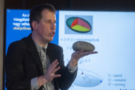
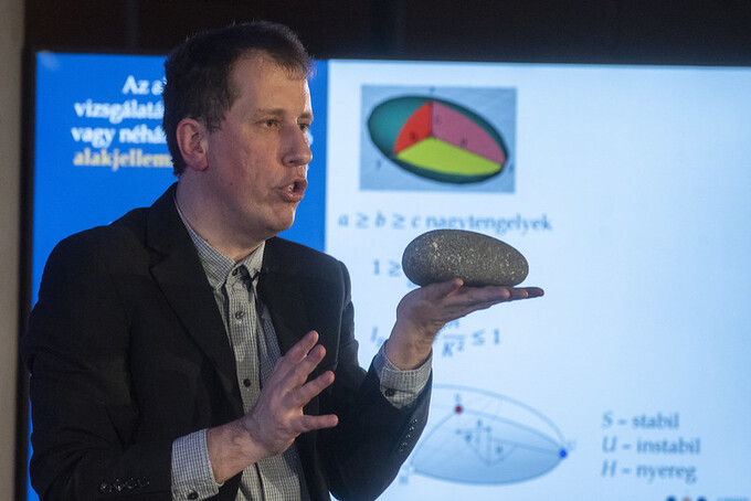
Geometria és alakfejlődés a természetben – Sipos András Árpád előadása videón
Hogyan írhatók le a természet alkotta formák szavak helyett a matematika eszköztárával? Milyen folyamat eredményeként jön létre a természetben egy spirál, és mi köze hozzá az evolúciónak és a csigaháznak? Ez is kiderült Sipos András Árpád építészmérnök, matematikus előadásából, amelyet a Tudományünnep+ keretében tartott.
TOVÁBB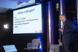

Miért zöld a fehér hidrogéngáz? – Lente Gábor előadásának felvétele
A címben említetteken kívük létezik sárga, rózsaszín, kék, szürke, fekete és türkiz hidrogén is – a valóságban persze mindegyik színtelen gáz. Az ember által ráaggatott „szín” a gáz forrására utal, ami viszont a fenntarthatóság szempontjából igen fontos tényező. Ezekről a színekről és gazdasági-technológiai-fenntarthatósági vonzataikról beszélt előadásában Lente Gábor fizikai kémikus.
TOVÁBB
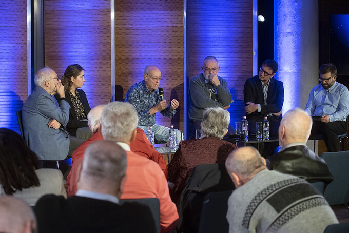
Klímaváltozás, biodiverzitás és akkumulátorgyártás, avagy kihívások és a fenntarthatóság néhány fontos dimenziója – Videón a Fenntartható Fejlődés Elnöki Bizottság tanácskozása
A fenntarthatóság fogalmát – mint azt a Magyar Tudományos Akadémia elnöke által életre hívott Fenntartható Fejlődés Elnöki Bizottság 2021-es alapításakor is hangoztatta – multidiszciplinárisan kell szemlélni. Ennek a szemléletnek a jegyében beszéltek az MTA tudományünnepi előadóülésének szakértői a biodiverzitásról és a klímaváltozásról, vizsgálták az akkumulátorgyártás technológiai kihívásait, valamint gazdasági és környezeti problémáit, de kitértek a fenntarthatóság egészségügyi vonatkozásaira is.
TOVÁBB
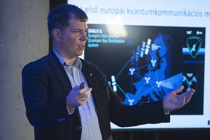
Műholdas kvantumkommunikáció: a jelen kihívásai, a jövő lehetőségei – Felvétel Bacsárdi László előadásáról
Miért érdemes a vezetékes kvantumos rendszereket kiegészíteni műholdas összeköttetéssel? Hol tart a kapcsolódó technológia? Hogyan járulnak hozzá a területhez a hazai szakemberek? Milyenek a jövőbeli fejlődési irányok? Mindez kiderült Bacsárdi László kvantuminformatikus előadásából.
TOVÁBB

Krausz Ferenc, az elektronok Nobel-díjas lesifotósa – Dombi Péter előadása videón
Az attoszekundumos lézerek lehetőséget adnak az elektronok molekulán belüli viselkedésének megfigyelésére, ami hihetetlen perspektívát nyit a kémiai és orvosi kutatások, valamint a diagnosztika számára. A tudományterület úttörője az idén Nobel-díjjal elismert Krausz Ferenc akadémikus, akinek munkásságáról tanítványa, Dombi Péter fizikus beszélt a Tudományünnep+ keretében. Előadása előtt videóüzenetben Krausz Ferenc köszöntötte az érdeklődőket.
TOVÁBB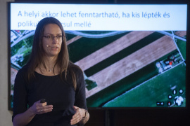

A helyi élelmiszerek szerepe a fenntartható fejlődésben – Videó az előadásról
„Csökkenő környezetterhelés”, „a helyi gazdaság támogatása”, „fenntarthatóság” – hangzatos, jól kommunikálható, „zöld” kulcsfogalmak. De valóban hozzájárul a helyi élelmiszer termelése és fogyasztása a fenntartható fejlődéshez? Többek között ezzel a kérdéssel kapcsolatban is sok újdonság derült ki a Tudományünnep+ hétfői előadásán. Benedek Zsófia biológus-közgazdász járta körül a helyi élelmiszerek fenntartható fejlődésben betöltött szerepének közel sem csupán helyi érdekű kérdéseit.
TOVÁBB
A változó világrend elméleti és regionális megközelítésben – Felvétel az előadásokról
Melyek a nemzetközi kapcsolatok átalakulásának legfontosabb jellemzői, milyen lehetőségei vannak a klasszikus diplomáciának ebben az átalakulásban, és milyen szerepet játszik a változó világrendben a Balkán, a Közel-Kelet, Kína, Kelet-Ázsia, Afrika, illetve Latin-Amerika? Ezekre a kérdésekre keresték a választ az MTA Gazdaság- és Jogtudományok Osztálya Nemzetközi és Fejlődéstanulmányok Tudományos Bizottsága által szervezett tanácskozás előadói.
TOVÁBB
Az új fejedelem: előadás és kerekasztal-beszélgetés a mesterséges intelligenciáról – Videón a péntek esti program
Lehetőség eddig leküzdhetetlennek tűnő problémák megoldására vagy az emberiség létét fenyegető veszély? A mesterséges intelligencia kapcsán sok szélsőségesnek tűnő vélemény látott napvilágot az elmúlt években. Reménykedjünk vagy féljünk? Mit várhatunk tőle, és mire kell ügyelnünk a mesterséges intelligenciát használva? Egyebek mellett ezekre a kérdésekre válaszolt a Magyar Tudomány Ünnepe Tudományünnep+ rendezvényén Csepeli György szociológus. Az előadást kerekasztal-beszélgetés követte, amelynek résztvevői természet- és társadalomtudományi megközelítésből vizsgálták a kérdéskört.
TOVÁBB
Egy nap diákokkal és a mesterséges intelligenciával – Az akadémiai rendezvény felvételei
Mi történik most, és mire készüljünk? Erre a kérdésre válaszoltak a legavatottabbak – matematikus, nyelvész, mesterségesintelligencia-kutató, társadalomkutató – a Magyar Tudomány Ünnepe és a Középiskolai MTA Alumni Program közös, pénteki akadémiai rendezvényén.
TOVÁBB

Extrém fényimpulzusok a tudomány és a társadalom szolgálatában – A Nobel-díjas Gérard Mourou angol nyelvű előadása videón
Az extrém lézerimpulzusok általános eszközt adnak a kutatók kezébe nagyenergiás sugárzás és részecskék előállítására, emellett képesek nagy térerősséget, nagy nyomást, hőmérsékletet és gyorsulást is létrehozni. Segítségükkel a fizika olyan máig megválaszolatlan kérdéseire kaphatunk választ, mint a 10²º eV-nál nagyobb energiájú kozmikus sugárzás eredete vagy a fekete lyukakban végbemenő információvesztés. Erről is beszélt a francia kutató tudományünnepi előadásában.
TOVÁBB

A körforgásos gazdaság szerepe a fenntartható fejlődési célok (SDGs) teljesítésében – Videó a tanácskozásról
Mi az a körforgásos gazdaság, és milyen feladatai vannak ennek kapcsán a társadalomnak, illetve a tudománynak? Erről tanácskoztak a Magyar Tudomány Ünnepe keretében az MTA Agrártudományok Osztálya és az MTA Körforgásos Gazdaság Osztályközi Állandó Bizottság közös rendezvényének résztvevői.
TOVÁBB

A hazai egészségügyi alapellátás teljesítményének értékelése – Videók a tanácskozásról
Az alapellátás fejlesztésében számos hazai intézmény és szakmai szervezet vesz részt. Képviselőik találkozója lehetőséget adott arra, hogy sajátos szempontjaikat, fejlesztési prioritásaikat és eddigi eredményeiket bemutassák, illetve a problémák kezelésével kapcsolatos elképzeléseiket megvitassák. A szimpózium során ismertették az egészségügyi alapellátás teljesítményével kapcsolatos eredményeket, a teljesítményértékelés eszközeit, és javaslatokat fogalmaztak meg a fejlesztések kívánatos irányáról is.
TOVÁBB

Mesterséges intelligencia: tudomány vagy technológia? – Szegedy Balázs tudományünnepi előadásának felvétele
Mit várhatunk a mesterséges intelligenciától, és mit biztosan nem? Egyáltalán mi számít MI-nek? Kifinomult statisztikai automata, szavakkal zsonglőrködő üresfejű robot vagy egy lassan ébredező valódi intelligencia? Szegedy Balázs matematikus válaszolt napjaink egyik legfontosabb, a tudományt és a mindennapjainkat is megváltoztató kérdésére.
TOVÁBB

ChatGPT: hogyan működik, mire jó, mennyire veszélyes? – Videón Prószéky Gábor előadása
Kérdezünk tőle, csevegünk vele, tudása pedig kimeríthetetlennek tűnik. Ez a ChatGPT, amelyről nagyon sokat hallottunk, de arról már sokkal kevesebbet tudunk, hogy miből táplálkozik ez a mindentudás, hogyan működik a ChatGPT, és miben támaszkodhatunk rá valójában. Prószéky Gábor programtervező matematikus, nyelvész segített válaszolni tudományünnepi előadásában.
TOVÁBB
2025: az MTA 200 éves – Felvétel a tanácskozásról
1825. november 3-án ajánlotta fel Széchenyi István birtokainak egyévi jövedelmét egy Magyar Tudós Társaság megalapítására, és ezzel lehetővé tette a Magyar Tudományos Akadémia megalapítását. A bicentenáriumra ünnepi rendezvénysorozattal készül az MTA. A tanácskozáson ezekről az előkészületekről és a 200. évforduló jegyében már elkészült kiadványokról számoltak be a résztvevők.
TOVÁBB
Nők a tudományban: új eredmények a klíma, a talaj és az emberi szervezet kutatásában – Videón a tanácskozás
Hogyan hatottak a gyors klímaváltozási események Európa prehisztorikus kultúráira? Miként határozza meg a földi élet minőségét a talaj? Milyen jelentősége van az immunrendszer eddig rejtett szereplőinek az immunitásban? Hogyan segítik a chip-eszközök az orvosbiológiai kutatásokat? Kérdések, amelyekre négy kutatónő válaszolt az MTA hagyományos tudományünnepi rendezvényén. Az előadásokat kerekasztal-beszélgetés követte.
TOVÁBB
A tudások feszültségei a megismerő emberben. A modern pszichológia hozzászólása a tudományos világnézet vitáihoz
A Magyar Tudomány októberi számában megjelent írásában Pléh Csaba akadémikus amellett érvel, hogy igenis van tudományos világnézet, és egyik társadalmi feladatunk ennek felmutatása, ráébresztés arra, hogy ez nem egy felkent kaszt különleges tudáshozzáféréséből származik, hanem a mindannyiunk rendelkezésére álló kritikai gondolkodásból.
TOVÁBB
Határtalan lehetőségeket kínálunk a fiataloknak – Interjú a Nobel-díjas Krausz Ferenccel
Nem sokkal a hír bejelentése után interjút adott az mta.hu-nak a Nobel-díjas fizikus. Krausz Ferencet kérdeztük a díjhoz vezető kutatásokról, felajánlásáról az ukrajnai háború károsultjai számára, a rák, a cukorbetegség és más egészségügyi problémák korai felismeréséről, valamint arról, hogy miért válassza egy fiatal kutató éppen az attoszekundumos fizika területét.
TOVÁBB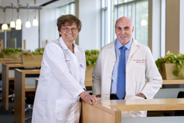

Karikó Katalin Nobel-díjas
A 2023-as orvosi-élettani Nobel-díjat Karikó Katalin és Drew Weissman kapták megosztva biokémiai felfedezéseikért, amelyek lehetővé tették egy hatékony mRNS-alapú vakcina kifejlesztését a COVID-19 ellen.
TOVÁBB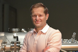
Krausz Ferenc Nobel-díjas
A 2023-as fizikai Nobel-díjat megosztva ítélték oda Krausz Ferencnek, Pierre Agostininek és Anne L’Huillier-nek „kísérleti módszereikért, melyek az anyagban jelen levő elektronok dinamikájának vizsgálatában alkalmazható attoszekundumos fényimpulzusokat generálnak”.
TOVÁBB